Ok, at least ferry terminal is rail related, being the headquarters for the Southern Pacific railroad empire. I’ll admit I’m a sucker for old landscape pictures. What I find so interesting about this picture, is what’s not in the picture. In 1925 the SF/Oakland Bay Bridge was only a dream. In 14 years the area adjacent to Yerba Buena island’s north side, and behind the clock tower, will become the nearly square mile site of the 1939/40 Golden Gate International Exposition. Thus, Treasure Island is formed.
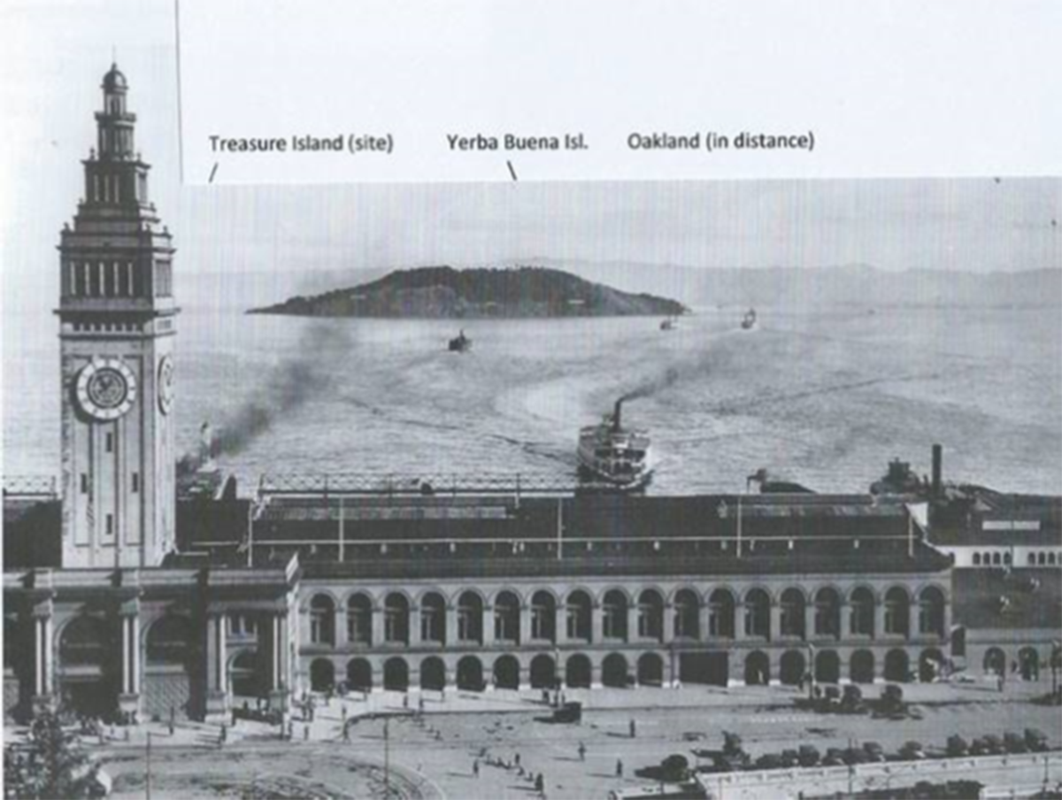
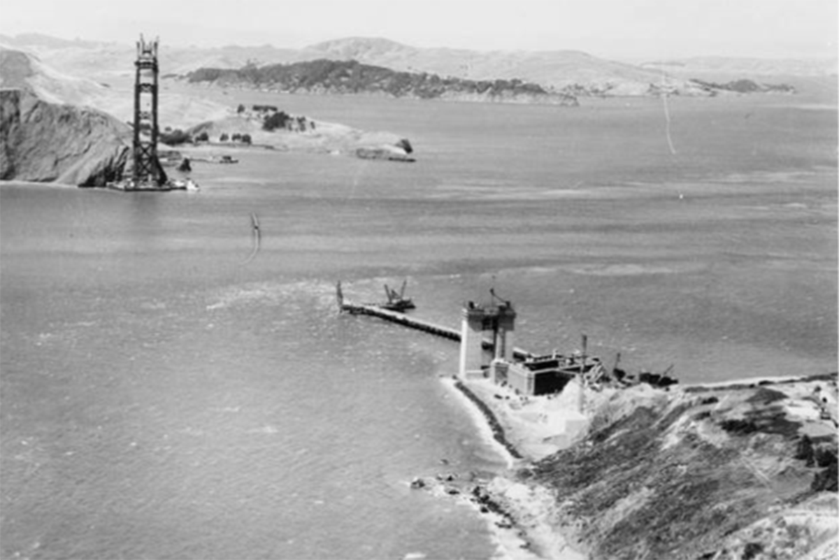
The shoals immediately north of Yerba Buena Island were a danger to shipping. Creating an artificial island by placing a jillion tons of rock and massive dredging of the harbor quelled that hazard. By the time the expo was over, war was brewing and the Navy seized the newly created island. It became a training base including an airfield. In 2007 the government sold the island to the City of San Francisco. On-going now is a multi-billion Treasure Island Development project for up to 8,000 new residences, 140,000 square feet of new commercial and retail space. The picture (above) is pretty cool too, taken in about 1936. The north tower of the Golden Gate bridge is near completion. The caisson for the south tower at the end of the temporary pier is not yet complete. The massive concrete structure at water’s edge is not part of the tower, rather a support for what will become the bridge approach. The adjacent land is part of the Presidio of San Francisco. The bridge opened in 1937 and a few years later a hurricane swept through the “Golden Gate” and to this day there are claims bridge is out of alignment, inward, by about 18 inches.